From the Field: Americas Research Interest Group
by Gabriela Martínez, Assistant Professor, School of Journalism and Communication and Stephanie Wood, Senior Research Associate, CSWS Bety Cruz takes a close look at pre-Columbian pottery bits.
Today we went to some Zapotec communities not far from Oaxaca city, accompanied by Beatriz (“Bety”) Cruz, a graduate student from the same region who is studying to be an ethnohistorian. Her thesis, under the guidance of María de los Angeles Romero Frizzi, will have as its focus several manuscripts, including an 18th-century mapa that we are digitizing at WHP for our Mapas Project. Bety arranged with the local town council of Guelacé for us to take a copy of the mapa and walk around the boundaries and sites that appear on the manuscript, marking various coordinates using a GPS instrument. Four town council members accompanied us, helping us locate various boundary points that mark the limits of the community-held lands. They also showed us various ex-haciendas (private estates) that were broken up after the Mexican Revolution and distributed to the families who had worked the lands. Bety carried the manuscript-map, Stephanie shot stills photos, and Gaby took video footage. Stephanie taught Bety to use the GPS tool.
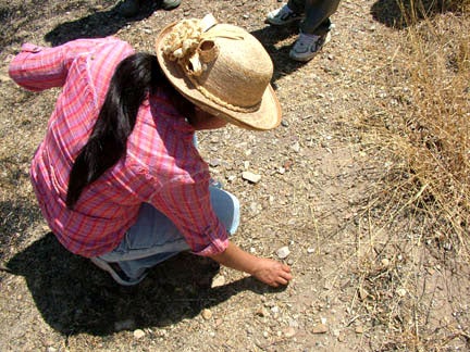
 Bety Cruz takes a close look at pre-Columbian pottery bits.
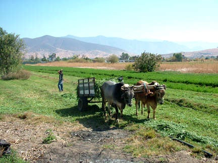
The countryside was filled with blossoming trees and lush fields. Many people were out harvesting alfalfa. One place that we located from the manuscript was a group of “negrito” (little black) trees that bear a small round fruit that looks something like a very dark cherry. We tasted the fruit, and it was rather sweet. These trees are the site of a former annual fiesta after harvest time. We asked why this site was chosen, and the council members pointed out a nearby ruin of a small prehispanic settlement, which they called “Santo Domingo.” Originally it would have had a name with no Christian associations, of course. We climbed onto the mound and noticed some pre-Columbian pottery bits scattered about. Apparently this site continued to have a ritual significance until very recent times, but no longer. The men with us spoke Zapotec among themselves as we walked around, but their children and grandchildren do not speak this language. Cultural change is coming very rapidly to this region.
 Bety Cruz takes a close look at pre-Columbian pottery bits.
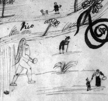
Another feature that appears on the map is a large, nude woman, way out of proportion to all the other humans who appear on the landscape. We kept asking people we met on our route if they might have any idea about the female figure from the manuscript. Finally, at the site of the former Santa Rosa Hacienda, where there is now a primary school, we met a teacher who explained to us the probable legend this figure represents. He referred to her as “matlatl-cihuatl” (net-woman, in Nahuatl), who is still believed today to haunt roads in this area. She can cast her spell (or net) over you, leading you to believe that she is someone you know. You accompany her to places you should not go, and you end up lost. This legend is somewhat reminiscent of the “Llorona” stories of female spirits who haunt the edges of rivers.
On Friday we will return to the region, to the neighboring town of Papalutla, where there are two colonial “lienzos” (pictorial manuscripts painted on cloth). One of these lienzos was nearly sold, surreptitiously, to a foreigner who was offering $40,000 U.S. dollars in 2007. Fortunately, for the sake of local history, it was saved in the nick of time! A Dutch ethnohistorian will tell us the story of this rescue, and if we are lucky, he will also obtain permission from the town council of Papalutla to work with us to examine the lienzos, the local landscape, and the stories of women and men who have inhabited this zone over the centuries.

